
Oulton Broad
Policy POOUL1: Boathouse Lane Leisure Plots
- The rural and semi-natural character of the area, its contribution to the views from the Broad, and floodwater capacity will be protected.
- Development will be strictly managed to support these aims, and in view of the poor road access and the serious risk of flooding affecting significant parts of the policy area.
- The provision of…
- small scale storage lockers for use incidental to the enjoyment of moorings, or
- modest sized single room day huts, storage sheds and boat sheds
will generally be permitted provided:
- the plot within which they are located remains predominantly open;
- the number of buildings does not lead to an over-developed site (usually one building
is acceptable); - in the case of day huts and storage sheds, that these are sited well back from the water’s edge and not prominent in views from the Broad; and
- the design, materials, and boundary treatments are not intrusive in the area or in views from the Broad.
- The raising of ground levels will not generally be acceptable, to retain flood capacity.
- The permanent or seasonal occupation of the land, vehicles, boats, etc., or the stationing of caravans, will not be permitted.
- In the light of the potential for archaeological remains in the area, an archaeological survey may be required in advance of any grant of planning permission.
Constraints and features
- Within Oulton Broad Conservation Area. Near (across broad) SAC, SPA, and SSSI.
- Article 4 Direction (1981) – removes permitted development rights for walls, gates, enclosures, etc.
- Flood risk (zones 1, 2 & 3 by EA mapping; mainly zones indicative 3b, and some zone 2, by SFRA 2018 mapping).
- Site is within Suffolk’s minerals consultation area for sand and gravel. However, the site is heavily constrained by flood risk, heritage and nature designations, dark sky areas, access, and amenity, so is likely not economically viable as a mineral extraction site.
Reasoned Justification
The area features some long-established leisure plots accessed by a narrow-unmade lane. The area forms an important part of the setting of Oulton Broad and the trees and shrubbery contribute to a semi-natural appearance. Maintaining an appropriate balance between the lawful use of the land and the control of additional buildings, structures, and vehicles that owners often want to install on their plots has been a challenge for many years.
The policy seeks to clarify what the Authority is trying to achieve and permit a basic level of built development in support of the plots’ lawful uses while minimising adverse impacts on the scenic beauty of the Broads and on the floodwater capacity of the area.
The Environment Agency supports the intention to keep buildings back from the river frontage/waterfront. While ‘well back’ is difficult to define and depends on particular local circumstances, in general setting the building back by a third of a plot could be appropriate. Being hard up or too close to the water’s edge could enclose the river or broad’s edge and be overbearing. Setting of buildings with an undeveloped area in front will also allow architectural interest of buildings to be appreciated.
Reasonable alternative options
No policy
Sustainability appraisal summary
The following is a summary of the assessment of the policy and alternative(s).
A: Keep original policy. 4 positives. 0 negatives. 0 ? Overall, positive.
B: No policy. 0 positives. 0 negatives. 4 ?
How has the existing policy been used since adoption in May 2019?
According to recent Annual Monitoring Reports, the policy has not been used and schemes were in conformity.
Why have the alternative options been discounted?
Given the importance of this area to the setting of the Broad, a policy that seeks to control development in the area is important and preferred.
Policy POOUL2: Oulton Broad - Former Pegasus/Hamptons Site
- This site is allocated for:
- a boatyard use; and
- (optionally) housing, recreation, entertainment, or employment use (or uses) where compatible with the boatyard use, road access, neighbouring uses and flood risk.
- Development of the site will be required to:
- Be of high standards of design in line with the Design Guide[169] (or successor document);
- Have high quality landscaping;
- Fully assess the impact of the development on the surrounding road network, demonstrate adequate capacity to meet the likely traffic demands and demonstrate adequate capacity or provision of satisfactory mitigation to meet the likely traffic demands of the site;
- Incorporate appropriate measures to manage any risk of water pollution arising from the development;
- Incorporate appropriate measures to mitigate or remedy any ground contamination;
- Provide evidence, including a site flood risk assessment, to confirm that any development will be consistent with national and local policy in terms of both on-site and off-site flood risks;
- Preserve or enhance the character or appearance of the Oulton Broad Conservation Area;
- Provide appropriate and safe access to the water (slipways, moorings) and facilitate views of the water; and
- The scheme provides biodiversity net gain (in line with policy PODM15).
- If housing forms part of the scheme, the provision of serviced self-build/custom build plots is encouraged.
- In the light of the potential for archaeological remains in the area, an archaeological survey may be required in advance of any grant of planning permission.
- Project Level Habitats Regulation Assessments will be needed to assess implications on Habitat Sites. Measures to mitigate for the effects of new growth may be required, in particular to mitigate recreation impacts (through the Suffolk Coastal GI RAMS tariff or equivalent mitigation as well as potentially the provision of good quality on-site green infrastructure).
Constraints and features
- Within the Oulton Broad Conservation Area.
- Opposite (across broad) SAC, SPA, SSSI.
- Flood risk zones 1, 2 & 3 by EA mapping and some 2 and indicative 3b by SFRA 2018 mapping.
- Future growth could have an impact on the foul sewerage network capacity.
- Close to a pumping station.
- A particular local issue is the congestion north of Mutford Lock
Reasoned Justification
Please note that this allocation received planning permission in 2012[170] for 76 market dwellings, office accommodation, and moorings. The policy is being carried forward from the 2019 Local Plan for the Broads because the permission is yet to be built out.
This is a visually prominent site on the Broad and the Authority has long sought redevelopment of the site. We recognise that it is unlikely that the whole of it will remain in boatyard use but seek to retain boatyard use and the availability of moorings, etc., at the waterside because of its importance to the local economy and the recreational value of the wider area. This policy sets out our approach to achieving such redevelopment and reflects the essentials of earlier adopted Supplementary Planning Guidance for the site, published jointly with the former Waveney District Council (now East Suffolk Council).
A particular local issue is the congestion north of Mutford Lock, as set out in the Local Transport Plan, which may be impacted upon by the development of this site. Any transport assessment under this policy should include this constraint. Suffolk County Council may seek contributions from this development, to mitigate any impacts on the highway network.
The Environment Agency highlights the need to address the risks of water pollution for waterside sites in industrial/boatyard use, and the need to deal with the risk of existing ground contamination.
There may be a requirement for an evidence-based project level HRA to assess the impact of this development on habitat sites and mitigation could be required. The scheme will also need to mitigate recreation impacts, and this is most easily done through paying the Suffolk Coastal GI RAMS tariff although there could be a need for open space that could provide adequate daily recreation and dog walking facilities to meet needs.
The policy highlights the need for the scheme to ensure Biodiversity Net Gain in line with policy PODM15.
The design of the development shall meet the requirements of the Design Guide and design policy PODM51.
There could be potential for serviced plots to be provided for people to build their own homes as part of any residential element of the scheme.
It is anticipated that the dwellings will be delivered as follows:
End 2025: 15
End 2026: 15
After 2027: 46
Reasonable alternative options
The original policy, with no amendments.
No policy.
Sustainability appraisal summary
The following is a summary of the assessment of the policy and alternative(s).
A: Keep original policy: 12 positives. 0 negatives. 0 ? Overall, positive.
B: Preferred Option - amend policy: 12 positives. 0 negatives. 0 ? Overall, positive.
C: No policy: 0 positives. 0 negatives. 12 ?
How has the existing policy been used since adoption in May 2019?
According to recent Annual Monitoring Reports, the policy has not been used.
Why have the alternative options been discounted?
The amendments relate to design, biodiversity net gain and HRA related issues which are important and are therefore the amended policy is preferred.
Policy POOUL3 - Oulton Broad District Shopping Centre
- New Town Centre Use Development (as defined in the NPPF) will be permitted within the Oulton Broad District Centre where the scale and function of the development is consistent with the role of the District Centre and would not impact on the vitality and viability of Lowestoft Town Centre.
- Within the Oulton Broad District Shopping Centre, proposals for changes of use of ground floor premises from Ea and Eb Class land uses to drinking establishments and hot food takeaways (sui generis) and other non-retail or town centre uses will not be permitted.
- The following changes of use of ground floor premises will only be permitted where either cumulatively or individually they have no significant adverse impact on the character, retail function and vitality and viability of the centre, residential amenity including noise, fumes, smell and litter, highway safety, parking, and community safety:
- From retail and financial and professional services (Class Ea and Ec i and ii) to restaurants and cafes (Class Eb)
- From any use other than retail and financial and professional services (Class Ea and Ec i and ii) in the Oulton Broad District Shopping Centre to restaurants and cafes (Class Eb), drinking establishments and hot food takeaways (sui generis).
- The Authority may seek to apply conditions limiting the ability to change use to other uses within Use Class E without the need for planning permission.
- Proposals will need to ensure they address other relevant policies in the local plan such as natural environment, flood risk (with the potential for a site-specific flood risk assessment being needed), water efficiency, provide well designed and well-located cycle parking, consider the provision of appropriately designed and located EV charging points, consider overheating and provision of shade, consider crime prevention and safety measures and provide biodiversity enhancements if appropriate.
Constraints and Features
- Flood Zone 3 and 2 according to EA mapping. Some 2 and indicative 3b by SFRA 2018 mapping.
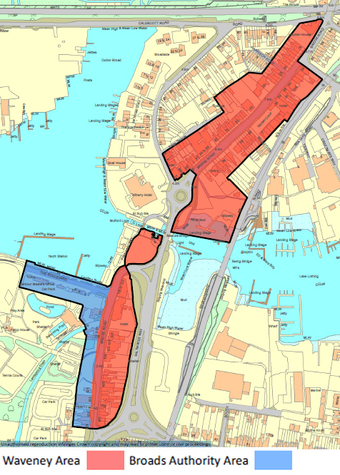
- The Centre is in East Suffolk and Broads Authority Local Planning Authority areas.
- Next to protected open space – Nicholas Everett Park.
- In Oulton Broad Conservation Area.
Reasoned Justification
The 2023 NPPF, at paragraph 90, says ‘planning policies and decisions should support the role that town centres play at the heart of local communities, by taking a positive approach to their growth, management, and adaptation’.
Recent retail evidence and on-site monitoring continues to identify Oulton Broad as a 'District Centre' where shops and services will be protected and prevented from changing to other uses. Planning Policy Statement 4 (PPS4) ‘Planning for Sustainable Economic Growth’ (now deleted) defines District Centres as a ‘group of shops, separate from the town centre, usually containing at least one supermarket or superstore, and a range of non-retail services, such as banks, building societies and restaurants, as well as local public facilities such as a library'. There is no definition for District Centres in the NPPG or NPPF.
Oulton Broad District Centre is located around Bridge Road in Oulton Broad. The area is shared between the Broads Authority and East Suffolk Council Local Planning Authority areas. There are around 58 retail units currently in operation (according to 2022 monitoring data).
Reproduced under license SLA100042052. from the Ordnance Survey mapping with the permission of the Controller of Her Majesty's Stationery Office © Crown copyright 2016. Unauthorised reproduction infringes Crown copyright and may lead to prosecution or civil proceedings.
The 2016 Retail and Leisure Study says that the Centre has a relatively good mix of independent stores for its size but an under provision of banks and building societies. The Centre was principally identified as a ‘top-up’ food-shopping destination in the household survey. The assessment suggests that there is potential to increase the convenience food offer as well as increase the number of cafés and restaurants to cater for the need of the local population and the wider tourist market. The assessment also identifies the potential to increase the linkages between the centre and the Broads.
The increase in the number of takeaways has been a cause for concern in Oulton Broad, with late opening times often being associated with anti-social behaviour that harms the amenity of local residents and the environmental quality of the areas. Concern has been raised that a continuation of this trend could reduce the centre's retail provision, making it less attractive for local residents and thereby potentially affecting the viability of the remaining shops.
Policy OUL3 is included within both the East Suffolk Council Local Plan and the Broads Local Plan to reflect the centre’s location across both planning authority areas. The policy intends to protect the existing shopping and service offer in the Centre and promote new restaurants and cafés where they would not undermine the viability of the Centre. The policy restricts changes of use to pubs and drinking establishments and hot food takeaways to address amenity concerns discussed previously.
It is acknowledged that some changes of use can take place without planning permission under the Permitted Development Order, which allows some flexibility of uses within the area (dependent on size, final proposed land use and whether the site is in the Broads or not). This policy will apply to circumstances where planning permission is required.
To prevent the proliferation of town centre uses in out-of-centre and edge-of-centre locations and to control their character, conditions will be used to restrict permissions granted for office, light industrial or research and development changing to other uses within Class E.
Of relevance will be the generic retail policy PODM34.
Reasonable alternative options
Original policy
No policy
Sustainability appraisal summary
The following is a summary of the assessment of the policy and alternative(s).
A: Keep original policy: 6 positives. 0 negatives. 0 ? Overall, positive.
B: Amended policy: 10 positives. 0 negatives. 0 ? Overall, positive.
C: No policy: 0 positives. 0 negatives. 10 ?
How has the existing policy been used since adoption in May 2019?
According to recent Annual Monitoring Reports, the policy has been used and applications have been determined in accordance with the policy.
Why has the alternative option been discounted?
East Suffolk Council, in their Waveney Local Plan, have a complimentary policy. The amendments relate to the change in class orders.
No results were found